
In early January, Storm Henk resulted in severe weather warnings and floods across the English Midlands. In April, flooding was widespread across England particularly on the south coast and the North East in the aftermath of Storm Kathleen and Storm Pierrick.
January
Flooding from the River Severn in Shrewsbury.
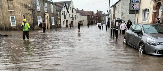
Storm Henk brought damaging winds and persistent rain to parts of England and Wales on 2 January, prompting severe weather warnings to be issued across the country. This led to more than 300 flood warnings being issued by the Environment Agency, with extensive flooding affecting the River Trent, Severn, Avon and Thames. The worst of the flooding occurred across parts of the Midlands including Leicestershire, Lincolnshire, Nottinghamshire, Northamptonshire, Gloucestershire, Worcestershire and Warwickshire.
Dunham Bridge, which carries the A57 over the River Trent, was closed to motorists for over a week. A number of roads were closed due to flooding in Nottinghamshire, such as the A6097 at Gunthorpe and the A617 at Kelham. Several roads in Gloucestershire were closed due to flooding, including the A417 at Maisemore which remained closed for over a week. In Alney Island, residents were evacuated from their homes as flood defences were close to overtopping.
April
In the aftermath of both Storm Kathleen and Storm Pierrick, a combination of an ‘exceptionally’ high tide and strong winds caused significant floods across the country overnight on 8 April, especially along the south coast of England. On 9 April, 43 flood warnings and 201 flood alerts were in place across England and Wales.
The River Arun in West Sussex burst its banks, leading to extensive flooding which caused one hospitalisation and the evacuation of over 200 people. In Littlehampton, firefighters had to evacuate 15 people after 42 caravans and properties in Ferry Road and Rope Walk flooded, with a refuge centre being set up by the council at the Littlehampton Wave leisure centre. 20 people were evacuated from the Bracklesham Caravan and Boat Club and the A259 road in Shoreham-by-Sea was completely flooded.
Flooding was particularly severe in Hampshire and on the Isle of Wight. In Alverstoke, firefighters had to help residents from around 50 homes to safety after they were flooded. Many coastal roads were left impassable, including Castle Street in East Cowes and Western Shore near Southampton, and flooding meant trains were unable to run at the Lymington Pier railway station. In Portsmouth, the high tides led to waves crashing over the sea wall near Clarence Pier, flooding the Old Portsmouth, Spice Island and Gunwharf areas. In Dorset, areas flooded included Hamworthy, Mudeford and Weymouth Harbour.
In Bristol, the Portway, which is a part of the A4, was flooded, and rail tracks between Clifton Down and Severn Beach were closed due to flooding after water rose above the tracks.
Floods also affected Cornwall with trains being cancelled and roads closed. Large waves hit Porthleven, a number of beach huts were swept into sea at Falmouth and many streets in Looe were flooded with seawater.
Areas of Northern England were affected by floods on 9 April. In Tyne and Wear, parts of the River Tyne burst its banks, with part of Newcastle’s Quayside being flooded despite the presence of flood barriers. Flooding on the rail line between Berwick-upon-Tweed and Newcastle were flooding, causing major disruption for passengers. In Northumberland, part of the A189 road was shut down after it was flooded and the River Aln flooded large areas of countryside near Alnmouth.
Rail services from northern England to Scotland and Wales were affected by flooding, including those from Carlisle to Glasgow and Edinburgh and Crewe to Holyhead.